The village is situated at 650 meters above sea level and has 18.306 inhabitants (2014). To the municipality belongs also: El Aire, El Chaparral, Parque del Cubillas, Pretel. Además, Loma Verde, Villas Blancas, El Torreón, Monte Elvira, Sierra Elvira and Buenavista. The birth of Albolote as population entity began with the arrival of the throne of the Kingdom of Granada in the Nasrid dynasty. It was created to give land and houses to the military garrison that defended the Camino Real from Jaen. The name derives from the Arabic toponym "Qaryat al-Bollut" meaning "Farmhouse of the Oaks". In the surroundings of Albolote in Sierra Elvira, the battle of the Higueruela took place on July 1, 1431, in which the troops of Juan II of Castile defeated the armies of Granada. In the Hall of the Battles of the Monastery of El Escorial is a work that refers to this battle, in which the name Albolote appears .
Points of Interest in Albolote
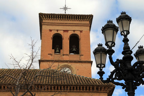
- Church: Iglesía Parroquial de Nuestra Señora de la Encarnación (16th century);
- Watch tower: La Atalaya o "Torreón" (13th century);
- Sierra Elvira;
- "Ruta de los Nazaríes";

Festivities in Albolote
- On the 2nd of February the Día de la Candelaría is celebrated with a picnic close to the watchtower "Torreón";
- On the 19th of April the Procesión del Cristo de la Salud is held in memory of the earthquake that took place in 1956;
- On the 3rd of May the Dia de la Cruz is held:
- In the first weekend of August the festivities in honor of the patron Santísimo Cristo de la Salud are celebrated;
Photo Gallery of Albolote
Basic Information Albolote
Albolote (37°13′50″N 3°39′26″O)
Altitude: 650 meters
Population: 18.306 inhabitants (2014)
Distances:
Distance to Granada: 12 km
Distance to the beach: 76 km
Distance to Airport Malaga: 133 km
Distance to Airport Granada: 14 km
Touristic level: low - medium - high
Authentic level: low - medium - high
Facilities:
- Supermarkets: yes
- Banks:yes
- Restaurants: yes
- Bars: yes


