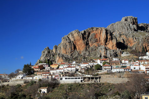
The village is situated at 1009 meters above sea level and has 2.043 inhabitants (2014). Like all the town in the Vega, Cogollos has been occupied by man since prehistoric times and some historians argue that its name comes from pre-Islamic topónimo Quqululus.
The rest of its history is closely linked to that of Granada. Its geographical location halfway between Vega and the foothills of the Natural Park of Sierra de Huétor, with its great masses of holm oaks and gall oaks which gives you a magnificent scenery and splendid natural spaces to enjoy.
Points of Interest in Cogollos de la Vega
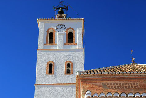
- Church: Iglesia Parroquial de la Anunciación (16th century);
- Arabic baths; they are located in the oldest part of the town (12th century);
- Arabic watchtower: "El Torreón";
- Sierra Arana;
- Natural Park Sierra de Huétor;
- Cave; "Cueva del Agua":
La Cueva del Agua is situated on the hillside of the Cabezo del Asno peak in Sierra Arana, at 1.700 m. The access is by two forest roads, one of Cogollos Vega and Deifontes, and another that starts in place of "El Sotillo" Iznalloz, the real gorge of Sierra Arana. The cave is more than 180 m deep, almost naturally with the development of their sockets extending over three km;

Festivities in Cogollos de la Vega
- On the 3rd of May the festivities of "La Cruz" are celebrated;
- On the 13th of June are the festivities celebrated in honor of the patron San Antonio de Padua;
- In the first weekend of October are the festivities celebrated in honor of Santísimo Sacramento.

Photo Gallery of Cogollos de la Vega
Basic Information Cogollos de la Vega
Cogollos Vega (37°16′24″N 3°37′07″O)
Altitude: 1009 meters
Population: 2.043 inhabitants (2014)
Distances:
Distance to Granada: 15 km
Distance to the beach: 83 km
Distance to Airport Malaga: 145 km
Distance to Airport Granada: 26 km
Touristic level: low - medium - high
Authentic level: low - medium - high
Facilities:
- Supermarkets: yes
- Banks: yes
- Restaurants: no
- Bars: yes


